(850) 230-1882 info@ecoresource.com
Slide1 background

GIS & Mapping

ERC > Projects > GIS & Maps

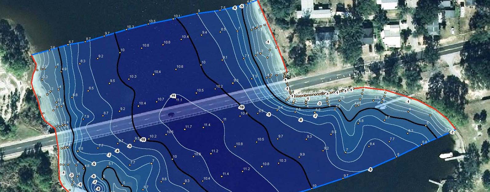
We have extensive Geographic Information Systems (GIS) Analysis / Mapping experience. In fact, as of 2016, we have evaluated over 2 million acres of property throughout Southeast with may ongoing projects expanding the width and breadth of our experience. Our GIS / Mapping services also include:

  • ArcView and AutoCad Maps
  • Data Analyses & Summaries
  • Database Creation & Management
  • Map & Exhibit Creation
  • Data Automation
  • Air Photo Interpretation
  • Georectification of Current & Historical Aerials
  • Creation of Data Layers
  • Historic Data Research & Analyses
  • Spatial Data Creation